Close your eyes for a moment and picture this: the first light of dawn spills over a jagged granite ridge, painting the sky in shades of amber and rose. Below you, a sea of clouds drifts silently through a valley dotted with ancient Buddhist temples. The air is crisp, carrying the faint scent of pine and incense. Somewhere in the distance, a temple bell rings — once, twice — and a chorus of birdsong answers. This is not a scene from your favorite K-Drama. This is the lived, breathtaking reality of hiking in South Korea.
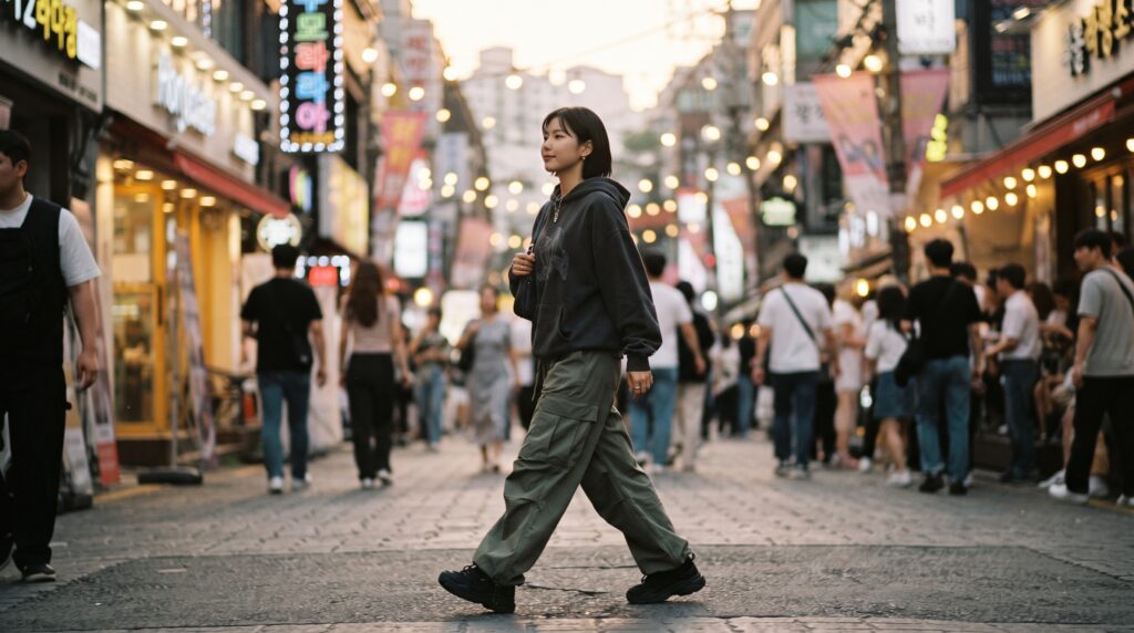
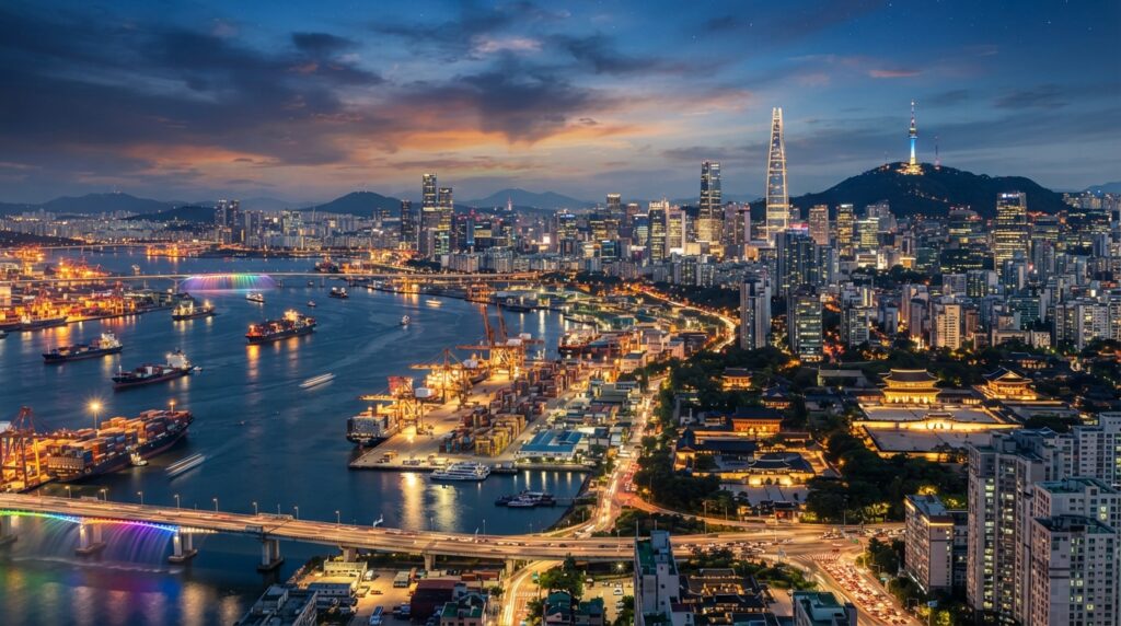
For too long, Korea’s mountains have played second fiddle to its pop culture exports. Tourists flock to Seoul’s neon-lit streets, line up for tteokbokki in Myeongdong, and chase K-Drama filming locations through city alleyways. And while all of that is wonderful, it only tells half the story. The other half — the deeper, older, more soul-stirring half — is written on mountain trails that stretch from the volcanic peaks of Jeju Island to the granite spires of Seoraksan in the northeast.
This guide exists to tell that full story. Whether you are a K-Drama fan curious about those sweeping mountain backdrops, an adventure traveler planning your first trip to Korea, or a culture enthusiast wanting to understand what truly moves the Korean spirit, you have come to the right place. By the time you finish reading, you will know exactly which trails to walk, which seasons to visit, what to pack, and what no drama or travel brochure has ever properly shown you about Korea’s mountains.
Why South Korea Is a Hiker’s Hidden Paradise
Ask most international travelers what comes to mind when they think of South Korea, and the answers are predictable: K-Pop, K-Dramas, Korean BBQ, skincare. Rarely do mountains make the list. Yet for the 51 million people who live there, mountains are not a weekend luxury — they are a way of life.
A Country Built on Mountains
South Korea is, geographically speaking, a mountainous nation. Approximately 70% of its total land area is covered by mountains and hills, making it one of the most rugged countries in East Asia. Unlike the sweeping, untamed wilderness of Patagonia or the Himalayas, Korea’s mountains feel intimate. They rise steeply from the edges of cities, tuck ancient temples into their forested folds, and reward even modest climbs with views that seem disproportionately grand.
This geography has shaped Korean civilization for thousands of years. Mountains served as natural fortresses during times of war, as sacred spaces for Buddhist and shamanist worship, and as communal gathering grounds for ordinary people seeking rest and renewal. The concept of Sansin — the Mountain God — is deeply embedded in Korean spiritual culture. Nearly every significant peak in Korea has a Sansinmyo (mountain god shrine) somewhere along its trail, a quiet reminder that these are not merely landscapes but living presences in Korean cultural memory.
The Korean Hiking Culture You Need to Know — Deungsan
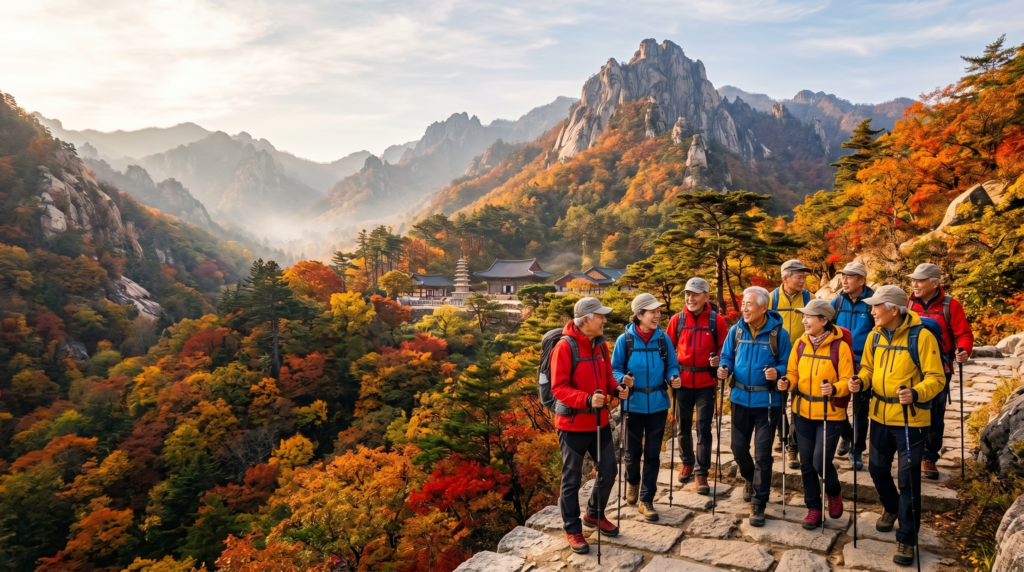
If you visit any major Korean city on a Saturday morning and head toward the nearest mountain trailhead, you will witness something remarkable. Hundreds — sometimes thousands — of people of all ages, dressed in matching technical gear in vivid shades of red, yellow, and electric blue, streaming toward the hills with the cheerful determination of people going somewhere they genuinely love.
This is deungsan (등산), Korea’s beloved hiking culture, and it is one of the most distinctive social phenomena in the country. Surveys consistently rank hiking as one of South Korea’s most popular leisure activities, cutting across age groups and social classes in a way that few other pastimes do. Grandparents tackle serious summit routes. Office workers decompress on forested ridge trails. University students hike overnight to catch sunrise from a peak. Families turn Sunday trail walks into multigenerational traditions.
The fashion element alone deserves mention. Korean hiking culture has an almost theatrical relationship with gear. High-performance, brightly colored hiking attire from brands like K2, Blackyak, and The North Face Korea is worn with the same pride and care that a fashion-conscious Parisian might give to a tailored coat. Far from being superficial, this reflects a genuine culture of preparedness and respect — both for the mountain and for the shared social experience of climbing it together.
The Best Hiking Trails in South Korea — By Experience Level
One of the most practical things to understand about hiking in South Korea is just how accessible it is. The country maintains an extensive network of 22 national parks and dozens of provincial parks, most with well-marked trails, clean facilities, and affordable entrance fees. Whether you have never hiked before or you regularly tackle multi-day alpine routes, there is a Korean trail built for you.
🟢 Beginner-Friendly Trails
Namsan, Seoul
In a city of 10 million people, few would expect to find a genuinely rewarding hiking experience rising from the urban center itself — but Namsan delivers exactly that. Located in the heart of Seoul, this 262-meter peak is threaded with walking paths through forested hillsides and leads to the iconic N Seoul Tower, one of the most recognizable landmarks in the country. Trails are gentle, well-paved in sections, and accessible from multiple starting points across central Seoul. It is the perfect introduction to Korean trail culture without requiring a single bus or train out of the city. Morning walkers, evening strollers, couples, and elderly residents share the paths in a quietly communal rhythm that is entirely Korean in character.
Ansan Jarakgil Trail, Seoul
Less famous than Namsan but beloved by Seoul locals, the Ansan Jarakgil Trail offers a flat, forested loop of roughly 7 kilometers through the hills of Mapo-gu. It is ideal for those seeking a meditative forest walk rather than a summit climb. The trail is well-shaded in summer and beautifully atmospheric in autumn when the maple and ginkgo trees turn gold.
Hallasan Eorimok Trail, Jeju Island
For visitors to Jeju Island, the Eorimok Trail on the slopes of Hallasan — South Korea’s highest peak at 1,950 meters — offers a beginner-friendly taste of this remarkable volcanic mountain. The trail winds through dense silver grass fields and ancient forests of twisted trees, with sweeping views that open gradually as you ascend. Note that the summit itself (Baeknodam Crater) requires a different, longer route and advance reservation, but the Eorimok Trail is a satisfying and accessible experience in its own right.
🟡 Intermediate Trails
Bukhansan National Park, Seoul
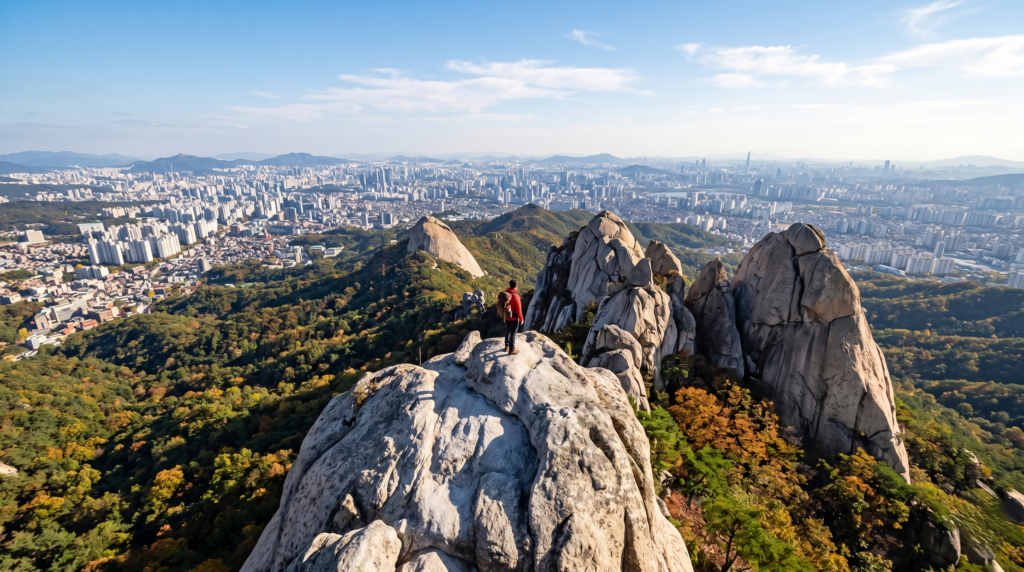
Bukhansan is, by almost any measure, one of the most extraordinary urban national parks in the world. Sitting directly on Seoul’s northern boundary, this park of dramatic granite peaks and forested valleys receives more visitors per square kilometer than virtually any other national park on the planet — a staggering testament to how central mountain culture is to Korean daily life.
The park’s signature route leads to Baegundae Peak (836 meters), the highest point in the park and one of the most rewarding day hikes in all of Korea. The trail ascends through thick pine and oak forests before emerging onto open granite slabs that require a degree of scrambling near the summit. The views from the top — Seoul spreading in every direction, the Han River glinting in the distance, the city’s skyline rising improbably behind ridgelines and temple rooftops — are nothing short of spectacular.
Trail tips: Start early on weekends (before 7 AM) to avoid peak crowds. The Satgat Gate andDobongsan area entrances offer slightly less congested alternatives to the main Baegundae approach. Entrance to the park is free, though a small conservation fee applies on some routes.
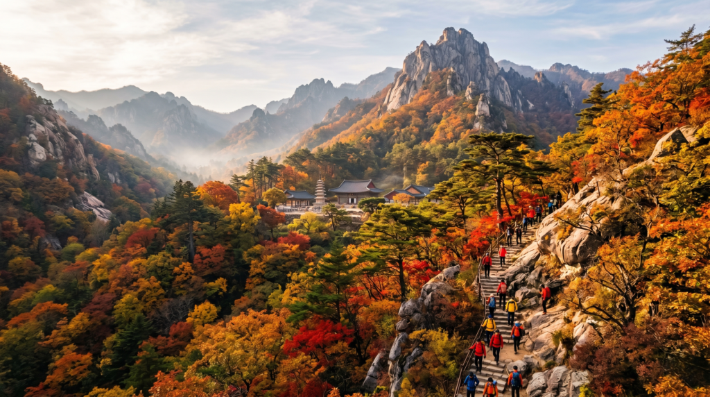
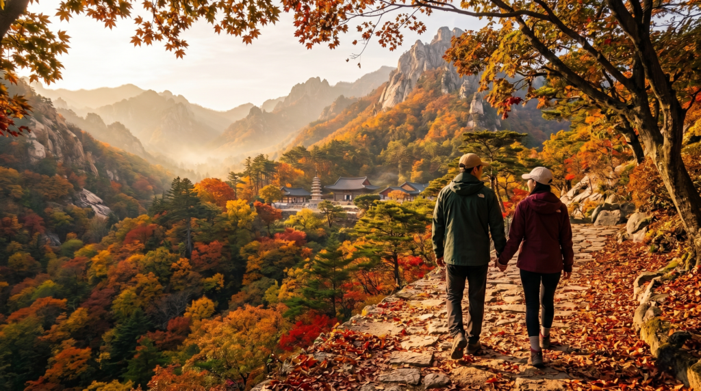
Odaesan National Park, Gangwon Province
If Bukhansan is Korea’s urban mountain, Odaesan is its quiet, contemplative counterpart. Located in the mountainous Gangwon Province northeast of Seoul, Odaesan is a park of ancient forests, Buddhist sanctuaries, and rare biodiversity. The trail to Birobong Peak (1,563 meters) passes through one of Korea’s best-preserved old-growth forests — towering Korean firs that create a cathedral-like atmosphere on misty mornings. Along the way, Woljeongsa Temple — a complex of extraordinary beauty dating back to the 7th century — sits at the trailhead like a spiritual welcome. Combining the forest trail with a temple visit makes for one of the most culturally rich hiking experiences in the country.
Gyeryongsan National Park, Chungnam Province
Gyeryongsan — whose name translates literally as “Rooster Dragon Mountain” — is a compact but dramatic park roughly two hours south of Seoul. Its trails traverse a series of sharp, photogenic ridgelines that earn the name. The Sambulbong Ridge Trail is a favorite among intermediate hikers for its panoramic views and challenging but manageable elevation changes. The park is also a significant site in Korean shamanism and folk religion, with a long history of spiritual activity that gives it an atmospheric quality distinct from Korea’s more conventional national parks.
🔴 Advanced and Challenging Trails
Seoraksan National Park, Gangwon Province
If there is one mountain destination in South Korea that captures the imagination completely, it is Seoraksan. Located near the east coast city of Sokcho, this UNESCO Biosphere Reserve is a landscape of such raw, dramatic beauty that it regularly tops both domestic and international lists of Korea’s finest natural scenery. Towering granite spires, cascading waterfalls, deep forested gorges, and high alpine meadows combine in a setting that feels genuinely otherworldly in the best possible sense.
For advanced hikers, the route to Daecheongbong Peak (1,708 meters) — the highest point in Seoraksan — is the ultimate prize. This is a serious mountain day: expect a 10–12 hour round trip with significant elevation gain, rocky terrain, and sections that require careful footing. The effort is rewarded with views that stretch on clear days all the way to the East Sea (Sea of Japan).
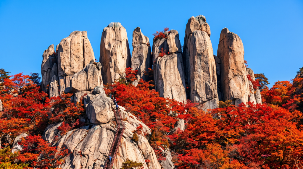
A more accessible but still challenging highlight is the Ulsanbawi Rock trail — a 6-kilometer round trip that ends at a dramatic cluster of six massive granite boulders rising 873 meters above sea level. The final ascent involves climbing a series of steep metal staircases bolted directly into the rock face, a thrilling finale that makes the destination feel genuinely earned.
Seasonal note: Seoraksan in autumn (mid-October) is universally regarded as one of the most beautiful natural spectacles in all of Korea. The foliage colors — crimson, amber, gold — against the grey granite faces are extraordinary. Book accommodation in the area months in advance for the October peak season.
Jirisan National Park, South Gyeongnam/Jeonnam
Korea’s first designated national park and its largest, Jirisan occupies a vast mountainous region in the southwest of the peninsula. For serious hikers, it offers something no other Korean park can: a genuine multi-day wilderness traverse. The Jirisan Ridge Traverse — running approximately 25 kilometers along the main ridgeline from Nogodan (1,507 meters) to Cheonwangbong (1,915 meters, Korea’s second-highest peak) — is considered the ultimate Korean hiking achievement.
The traverse typically takes two to three days, with overnight stays in the park’s network of mountain shelters (daepiso). Reservations for these shelters are mandatory and fill quickly, particularly in spring and autumn. The trail passes through zones of remarkable ecological diversity — cloud forests, alpine meadows, ancient temple precincts — and delivers an immersive mountain experience that feels a world away from urban Korea, despite being just hours from major cities.
Deogyusan National Park, North Jeolla/South Chungcheong
Deogyusan is Korea’s premier winter hiking destination. Its high ridgeline — the main peak, Hyangjeokbong, stands at 1,614 meters — receives heavy snowfall from December through February, transforming the mountain into a landscape of almost surreal winter beauty. Hikers equipped with crampons and proper layering systems come from across the country to walk snow-covered ridges under clear winter skies. The nearby Muju Ski Resort means that the area has robust infrastructure even in deep winter, making Deogyusan an excellent choice for those willing to brave the cold.
Quick Trail Comparison
| Trail | Difficulty | Best Season | Key Highlight |
|---|---|---|---|
| Namsan (Seoul) | Easy | All year | City views, N Tower |
| Ansan Jarakgil | Easy | Spring/Autumn | Forest loop, local favorite |
| Bukhansan | Moderate | Spring/Autumn | Granite peaks above Seoul |
| Odaesan | Moderate | Summer/Autumn | Old-growth forest, temple |
| Seoraksan | Hard | Autumn | Dramatic granite, foliage |
| Jirisan Traverse | Expert | Spring/Autumn | Multi-day ridge route |
| Deogyusan | Hard | Winter | Snow ridges, alpine views |
Hiking in South Korea and K-Dramas — The Connection You Didn’t Expect
If you have spent any meaningful time watching Korean dramas, you have almost certainly paused on a scene and thought: where is that? A lone figure standing on a windswept ridge at golden hour. Two characters finally confessing their feelings on a forested mountain path. A grieving protagonist sitting silently on a rocky outcrop, staring out at an endless valley below. These are not accidental backdrops. In Korean storytelling, mountains carry meaning — and understanding that meaning transforms both how you watch K-Dramas and how you experience Korea’s trails in person.
Why Korean Dramas Love Mountains
To understand why mountains appear so persistently in Korean drama narratives, you need to understand a concept central to the Korean emotional universe: han (한). Often described as an untranslatable feeling, han encompasses a deep, collective sense of sorrow, longing, and resilience — an emotional weight carried both personally and culturally across generations. Mountains, in Korean artistic tradition, are the natural landscape of han. They are places you go when the world becomes too loud, when grief needs space, when a decision is too heavy to carry on city streets.
This is why K-Drama writers consistently send their most emotionally burdened characters to high places. The mountain does not merely provide a beautiful frame — it provides narrative permission. In the language of Korean storytelling, a character who climbs a mountain is a character ready to feel something fully, without the social armor that urban life demands. The isolation, the physical effort, the vast perspective from a summit — all of it signals emotional openness. When two characters meet on a mountain trail in a K-Drama, something true is about to be said.
Beyond han, mountains in Korean culture also represent endurance, spiritual clarity, and national identity. The mountain is where Korea’s oldest myths are set — including the founding legend of the nation itself, in which the god-king Dangun descended from heaven to a mountain called Baekdusan to establish the Korean people. That mythological weight lingers in how Koreans relate to their peaks today, even unconsciously.
Famous K-Drama Filming Locations on Real Trails
Namsan and N Seoul Tower — Boys Over Flowers, My Love from the Star, Secret Garden
Perhaps no location in Korean pop culture carries more romantic weight than Namsan and the tower that crowns it. The tradition of couples attaching padlocks to the fences around N Seoul Tower — a symbol of eternal love — has appeared in so many K-Dramas that it has become a cultural shorthand for romantic commitment. The mountain trails leading up to the tower, particularly the forested paths through Namsan Park, have appeared as backdrop in countless pivotal scenes. Walking these trails today, you will encounter the real-life version of that tradition: thousands of padlocks in every color, engraved with names and dates, clinking softly in the breeze.
Seoraksan Area — Various Melodramas and Thriller Backdrops
Seoraksan’s dramatic granite faces and deep valley gorges have made it a frequent choice for production teams seeking landscapes that feel both grand and emotionally charged. The area around Osaek and the Outer Seorak valleys has appeared in numerous period dramas and contemporary melodramas as a location representing both beauty and danger — the mountain as sublime threat. If you have watched a Korean drama in which characters seem dwarfed by impossibly dramatic rock formations, there is a reasonable chance those rocks belong to Seoraksan.
Jeju Island — Hallasan and the Olle Trail — My Ajusshi, Warm and Cozy, Duel
Jeju Island occupies a special place in Korean drama geography. It is the destination characters escape to when Seoul has broken them — a place of healing, reinvention, and unexpected love. The gentle trails of the Jeju Olle Trail and the slopes of Hallasan have appeared in dozens of productions as the landscape of emotional recovery. The silver grass fields (eokpuri) of Hallasan’s upper slopes — swaying in unison under a wide autumn sky — are one of the most hauntingly beautiful images in Korean visual culture, deployed by drama directors with full awareness of their emotional resonance.
Bukhansan — Descendants of the Sun, Various Romance and Action Dramas
As Seoul’s most accessible dramatic mountain terrain, Bukhansan has appeared in action sequences, emotional confrontations, and quiet character moments in more Korean dramas than could easily be counted. Its combination of urban accessibility and genuinely wild-feeling granite terrain makes it uniquely useful for productions that need to convey both vulnerability and strength simultaneously.
💡 Tip for K-Drama Fans Planning a Trail Trip: Before your visit, search your favorite drama’s title alongside “filming location” (촬영지) in both English and Korean on Naver. Korean fan communities meticulously document exact filming locations, often down to the specific section of trail. Many locations have unofficial signs or community-placed markers, and local tourism offices in cities like Sokcho (near Seoraksan) and Seogwipo (Jeju) produce maps of drama filming sites in their regions.
What K-Dramas Get Wrong — and Right — About Korean Hiking
K-Dramas, for all their landscape beauty, do tend to romanticize the mountain experience in ways that can mislead first-time visitors.
What they get wrong: Characters in dramas often appear on mountain ridges in entirely impractical clothing — elegant coats, dress shoes, sometimes even heels. The ascent is almost never shown; characters simply arrive at the scenic viewpoint, perfectly composed, as though the mountain delivered them there gently. In reality, even moderate Korean trails involve steep stone stairways, uneven rocky paths, and the kind of sustained physical effort that produces sweat regardless of the season.
What they get right: The emotional atmosphere is entirely accurate. There genuinely is something about Korea’s mountain trails — the communal spirit on busy weekend routes, the sudden, absolute quiet of a forested valley on a weekday morning, the way a summit view seems to expand not just your eyeline but your entire sense of what is possible — that lends itself naturally to emotional revelation. Korean hikers often describe their trail experiences in language that sounds, to outside ears, almost spiritual. The mountains earn that language honestly.
The dress code reality, incidentally, is the opposite of drama glamour. Korean hiking fashion is technical, colorful, and intensely practical. Trekking poles are nearly universal. Proper hiking boots are considered essential courtesies as much as personal necessities. Arriving at a major Korean trailhead in casual sneakers will earn you gentle but unmistakable looks of concern from fellow hikers — particularly the elder generation, who treat mountain safety with genuine seriousness.
Essential Hiking Tips for South Korea — What Every Visitor Must Know
Knowledge transforms a good trip into a great one. The following practical guidance covers everything you need to hike South Korea’s trails with confidence, comfort, and cultural fluency.
Best Seasons for Hiking in South Korea
Spring (March to May) — Blossoms and Fresh Greens
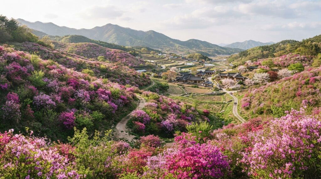
Spring is one of the two peak hiking seasons in Korea, and for good reason. As temperatures climb from the cold of winter, Korea’s lower mountain slopes erupt in cherry blossoms, azaleas, and fresh green growth that creates a landscape of almost impossible softness. Trails that were grey and bare in February are transformed within weeks into tunnels of pink and white bloom. The famous royal azalea (Cheoljjuk) blooms of Sobaeksan and Hwangmaesan — where entire mountainsides turn vivid pink in late April — are among the most spectacular natural events in the Korean calendar and draw enormous crowds.
Temperatures in spring are ideal for hiking — cool enough for sustained effort but warm enough for comfort. However, spring weather in Korea can be unpredictable, with yellow dust (hwangsa) from China occasionally reducing visibility and air quality. Check air quality forecasts (misemeonji levels) before heading out on spring hike days.
Summer (June to August) — Lush but Demanding
Korea’s summer is hot, humid, and interrupted by the Jangma (장마) monsoon season, which typically runs from late June through late July. This does not mean summer hiking is inadvisable — Korea’s forests are at their most lush and verdant, waterfalls run at full power, and higher elevation trails offer welcome relief from city heat. However, it does mean preparation is essential. Lightweight moisture-wicking clothing, high-capacity water carrying, and careful attention to weather forecasts are non-negotiable. Avoid hiking during or immediately after heavy rain, when trail surfaces become slippery and the risk of flash flooding in valley gorges increases significantly.
Autumn (September to November) — The Crown Season
If you can only visit Korea in one season for hiking, make it autumn — specifically October. Korea’s autumn foliage is internationally celebrated for good reason. The combination of the peninsula’s diverse tree species, its mountainous topography, and the particular quality of its October light produces foliage colors of extraordinary intensity. Maples turn blood red. Ginkgos become columns of pure gold. Oak and beech shift through every shade of amber and copper. Against the grey granite faces of parks like Seoraksan and Bukhansan, the effect is breathtaking in the most literal sense — it genuinely stops your breath.
Peak foliage timing varies by location and elevation. Seoraksan typically peaks in mid-October; Seoul’s mountains follow in late October to early November. Accommodation near popular parks books out months in advance during foliage season. Plan accordingly and book early.
Winter (December to February) — Snow and Silence
Winter hiking in Korea is an underrated and deeply rewarding experience for those properly equipped. Snow transforms Korea’s mountain landscapes into serene, austere beauty. Trails that were crowded in October are nearly deserted in January. The silence of a snow-covered Korean forest — broken only by the crunch of your footsteps and the distant call of a winter bird — is a kind of peace that is difficult to find anywhere else. Essential requirements for winter hiking include crampons (available for rent at most trailhead shops), layered technical clothing, and advance checking of trail conditions, as some higher routes close during icy periods.
Trail Permits, Fees, and Reservations
South Korea’s national park system is well-administered and remarkably affordable by international standards.
Entrance fees for most national parks range from free to approximately ₩3,000 (roughly $2.25 USD) for adults — a nominal amount that contributes to trail maintenance and conservation. Some parks, including Bukhansan, have eliminated entrance fees entirely in recent years.
Reservation requirements apply to specific high-demand trails. The summit route on Hallasan (the Seongpanak and Gwaneumsa trails to Baeknodam Crater) requires advance online reservation through the Korea National Park Service website (knps.or.kr), which offers an English-language booking interface. Similarly, the mountain shelters (daepiso) on the Jirisan Traverse must be reserved in advance — often weeks or months ahead during peak season. Failing to secure a reservation means being turned back at the trail entrance, regardless of how far you have traveled to get there.
For all other trails, no advance registration is required. Simply arrive, pay any applicable entrance fee at the gate, and hike.
What to Pack — The Korean Hiker’s Essential Kit
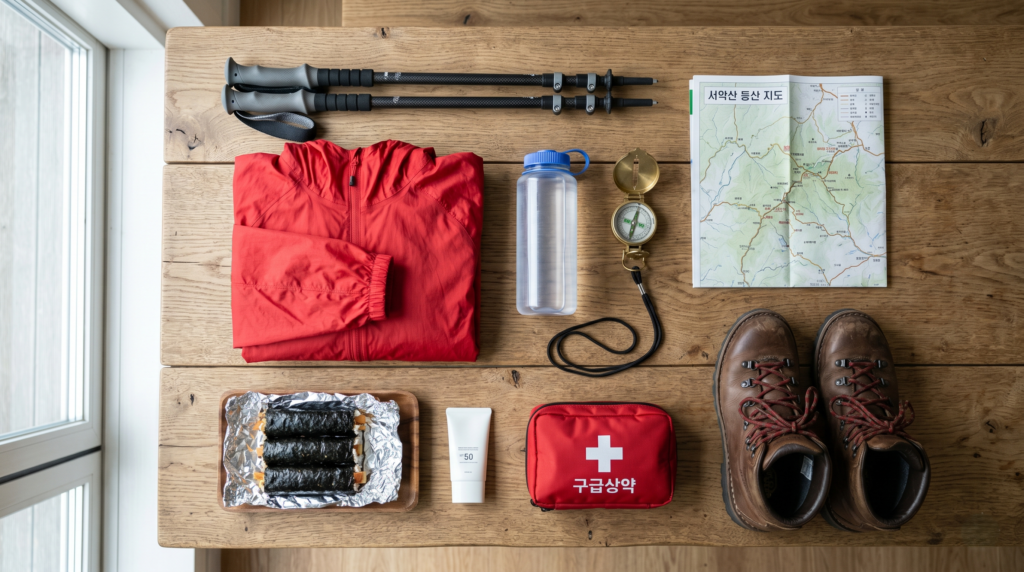
Clothing and Gear: Layering is the fundamental principle of Korean hiking preparation. A moisture-wicking base layer, an insulating mid-layer, and a waterproof shell jacket cover the vast majority of conditions across three seasons. In summer, the shell can be replaced with a lightweight rain jacket. Proper hiking boots with ankle support are strongly recommended over trail runners for Korea’s rocky, often steep terrain. Trekking poles — used by the overwhelming majority of Korean hikers of all ages — significantly reduce knee strain on descents and are worth bringing or renting at the trailhead.
Navigation: Naver Maps (Korea’s dominant mapping platform) has the most comprehensive trail data for Korean hiking routes, including detailed elevation profiles and real-time reviews from recent hikers. Download offline maps before entering areas with limited signal. KakaoMap is a solid alternative. Korea’s national park trails are well-signposted in both Korean and English, with distance markers and estimated time indicators at regular intervals.
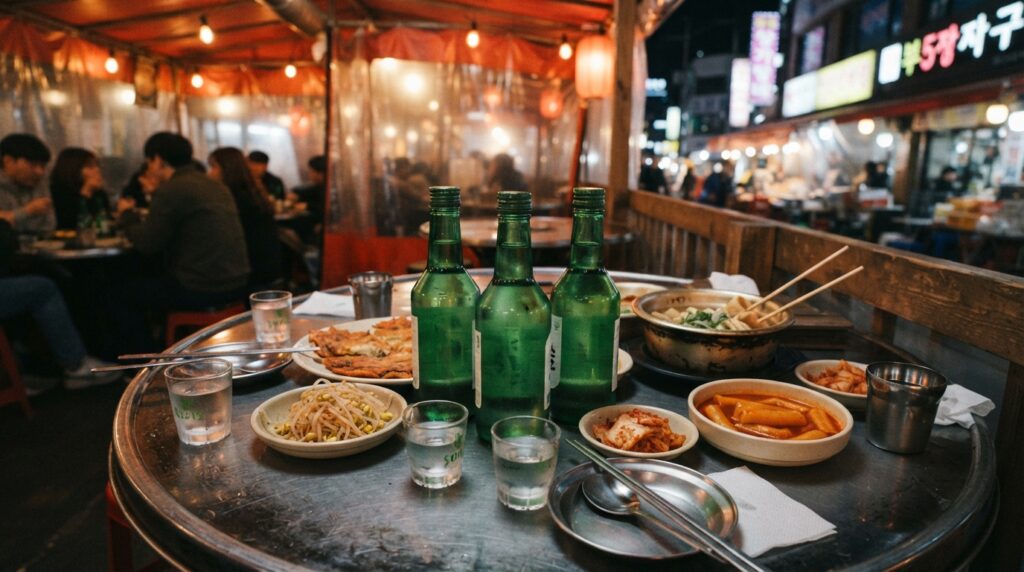
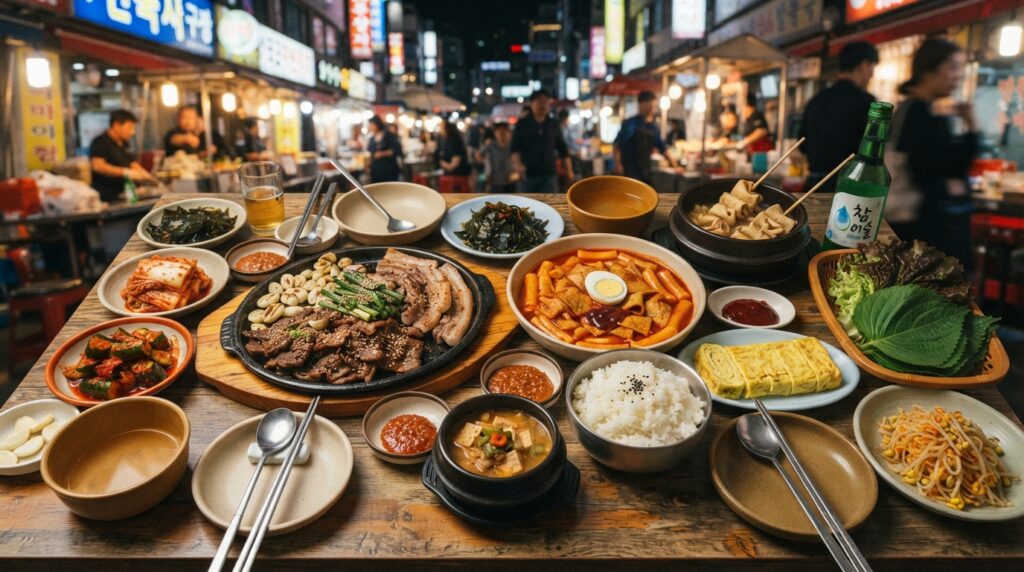
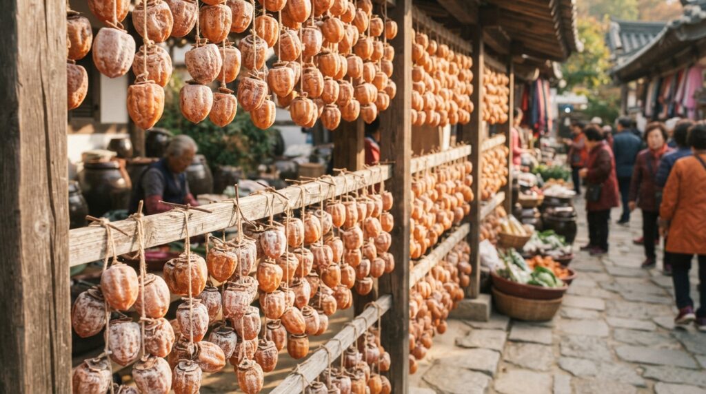
Food and Water: Hydration needs on Korean trails are higher than many visitors expect, particularly in summer and on longer ascents. Carry at least 1.5–2 liters of water per person for any hike over three hours. One of the great pleasures of Korean hiking culture, however, is the discovery of summit maejom — small refreshment stalls near the top of popular peaks where you can buy cold drinks, instant ramen, and traditional snacks. Trying sikhye (sweet rice punch) or a cup of instant corn soup at a mountain summit stall is an experience that is quintessentially, joyfully Korean. Pack gimbap (seaweed rice rolls) for trail snacks — they are portable, nutritious, and the unofficial food of Korean hiking culture.
Safety and Trail Etiquette
Korean mountain culture has its own social codes, and respecting them enriches the experience considerably.
Greetings: On Korean trails, passing hikers almost universally exchange “annyeonghaseyo” (안녕하세요) — a polite hello. As a foreign visitor, participating in this ritual is warmly welcomed and often sparks brief, friendly exchanges. It signals that you are engaging with the mountain as Koreans do — as a shared space requiring mutual acknowledgment.
Emergency services: Korea’s universal emergency number is 119, which covers mountain rescue as well as fire and medical emergencies. Major national park trails have emergency location markers (위치표지판) at regular intervals — small signs with numbered codes that allow rescue services to locate you precisely. Make a mental note of the nearest marker number whenever you see one.
Trail closures: Some trails close seasonally due to fire risk (typically in spring during dry periods), wildlife protection zones, or ice conditions. Check the Korea National Park Service website or the park entrance board for current closures before setting out.
Wildlife: Wild boar (meot dwaeji) are present in many of Korea’s forested parks, particularly Jirisan and Odaesan. They are generally shy and avoid human contact, but hikers in remote areas should make reasonable noise on the trail and avoid approaching any animal they encounter. Bear sightings, while extremely rare, have been documented in Jirisan — the park is home to a small, protected population of Asiatic black bears reintroduced as part of a conservation program.
Hidden Gem Trails Most Tourists Never Find
Beyond the famous national parks lies a network of provincial parks and lesser-known mountain destinations that offer comparable beauty with a fraction of the crowds. These are the trails that Korean hikers whisper about among themselves — places where you are more likely to encounter a monk on a morning walk than a tour group.
Gajisan Provincial Park, South Gyeongsang Province
Rising to 1,240 meters in the mountains of South Gyeongsang Province, Gajisan offers the dramatic rocky summits and sweeping ridge views of Seoraksan with none of the autumn weekend crowds. The trail to the main peak passes through ancient forest before emerging onto open rocky terrain with panoramic views across the southern peninsula. At the base of the mountain sits Tongdosa Temple — one of the three jewel temples of Korean Buddhism and a UNESCO World Heritage Site — making Gajisan one of the finest combinations of natural and cultural heritage hiking in the country.
Maisan Provincial Park, North Jeolla Province
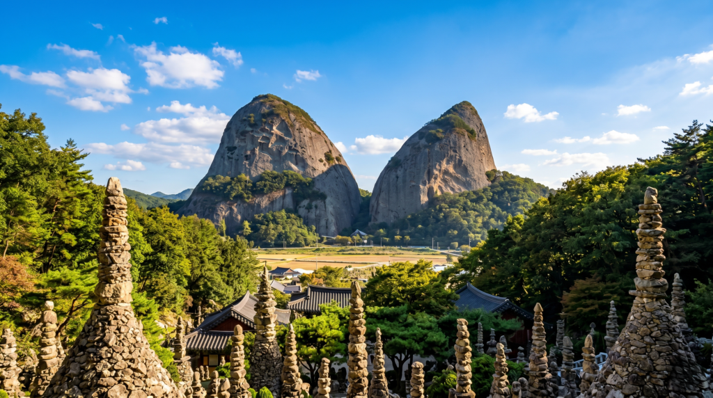
Maisan — “Horse Ear Mountain” — is genuinely unlike anything else in Korea. Two rocky peaks rising from the flat surrounding landscape look precisely like the upright ears of a horse, creating a silhouette so distinctive that it has been a source of wonder and mythology for centuries. Between the peaks sits Tapsa Temple, a remarkable complex of stone pagodas built entirely by hand by a single monk, Yi Gap-yong, who spent decades constructing over 80 stone towers without mortar — some standing over nine meters tall. The pagodas have survived intact for over a century, which local tradition attributes to miraculous structural harmony. Hiking Maisan and visiting Tapsa is a short but deeply memorable experience that few international visitors ever discover.
Daedunsan Provincial Park, North Jeolla/South Chungcheong Province
For hikers who want drama and adrenaline on a relatively short route, Daedunsan delivers both in spectacular fashion. The mountain’s final ascent involves crossing a suspension bridge strung between rocky pinnacles and climbing a near-vertical series of steel staircases bolted directly into the cliff face. It is exhilarating, photogenic, and entirely safe — but not for those with a serious fear of heights. The views from the top across the rolling hills of North Jeolla Province are expansive and beautiful, and the unusual infrastructure of the ascent makes Daedunsan one of the most uniquely photogenic hikes in Korea.
Jeju Olle Trail — For the Scenic Walker
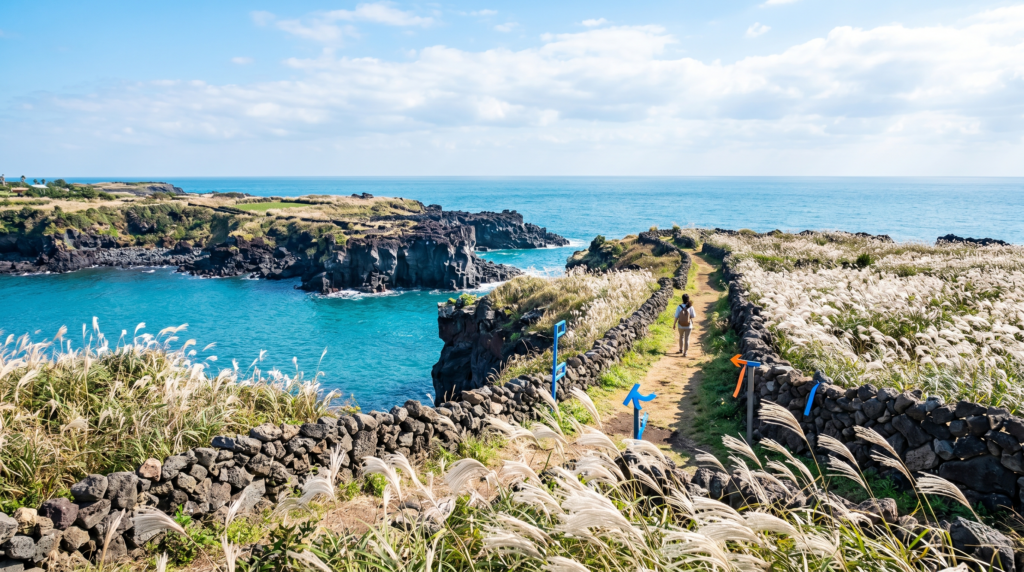
Not every remarkable hiking experience in Korea involves a summit. The Jeju Olle Trail — a network of 26 coastal and inland walking routes circling Jeju Island, totaling approximately 437 kilometers — is one of the finest long-distance walking trails in Asia. Developed from 2007 onwards by journalist Suh Myung-sook, who was inspired by the Camino de Santiago, the Olle Trail transformed Jeju’s relationship with slow travel and sparked a nationwide enthusiasm for geolgi (walking culture) that complemented the existing deungsan mountain hiking tradition.
Individual Olle sections range from 9 to 24 kilometers and can be walked independently in a day. The routes pass through volcanic lava fields, citrus orchards, coastal cliffs, rural villages, and the silver grass plains that make Jeju’s landscape so distinctive. For visitors who prefer walking to climbing, or who want a gentler alternative to Hallasan’s demanding summit trails, the Olle Trail offers an equally immersive experience of Jeju’s natural and human geography.
💡 Expert Insight: Korea’s provincial parks are administered separately from national parks and receive significantly less international attention — which means considerably less crowding on weekends and a more authentic, local experience. If your primary goal is to connect with Korean mountain culture rather than tick off famous summits, provincial parks like Gajisan, Maisan, and Daedunsan will serve you better than the headline destinations.
Korean Mountain Culture — The Soul Behind the Summit
To hike in South Korea without some understanding of the cultural framework surrounding mountain spaces is to see the view without reading the poem written about it. The mountains are more than scenery here. They are architecture of the Korean soul.
Buddhist Temples and the Mountain Path

Korea’s great Buddhist temples were almost universally built in mountain settings — not because flat land was unavailable, but because mountains were understood as spiritually elevated spaces, closer to the divine and further from the noise of human commerce. The Sansa — Korea’s mountain Buddhist temples — were inscribed as a UNESCO World Heritage Site in 2018 in recognition of their outstanding cultural value. Temples like Beopjusa (Songnisan), Haeinsa (Gayasan), and Woljeongsa (Odaesan) are not merely historical artifacts to be viewed from behind a rope line; they are living religious communities that have maintained continuous practice for over a thousand years. Walking the trail to one of these temples, passing through the forest that has sheltered it for centuries, and arriving at its wooden gates in the morning quiet is an experience of cultural depth that no museum exhibit can replicate.
Makgeolli at the Summit — A Beloved Tradition
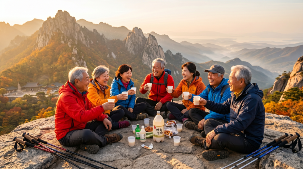
Among Korea’s most endearing mountain customs is the post-summit drink of makgeolli — a milky, lightly effervescent rice wine with an alcohol content typically between 6–8%. Small plastic cups of makgeolli, sometimes accompanied by pajeon (savory pancake) or dried snacks, are shared among hiking companions at the summit or in the rest areas near the top of popular peaks. Summit vendors often sell it chilled, and the combination of physical exhaustion, fresh mountain air, and the mild warmth of rice wine produces a contentment that Koreans describe with the single satisfying word: siwonhada (시원하다) — refreshing, cool, satisfying all at once. Participating in this tradition, if you are of age and inclined, is one of the most authentic ways to experience Korean hiking culture from the inside.
The Baekdu Daegan — Korea’s Mountain Spine
For those with a deep interest in Korean geography and culture, the Baekdu Daegan (백두대간) is a concept worth understanding. This is the great mountain spine of the Korean Peninsula — a continuous ridgeline running approximately 1,400 kilometers from Baekdusan on the North Korea-China border in the north all the way to Jirisan in the south. In traditional Korean geographic philosophy, the Baekdu Daegan was understood as the energetic backbone of the peninsula — the source from which all rivers flow and all regional identities descend. Completing a full or partial traverse of the South Korean section of the Baekdu Daegan is the ambition of serious Korean hikers, a multi-week undertaking that passes through the heart of the country’s most significant mountain landscapes.
Frequently Asked Questions About Hiking in South Korea
Q1: Do I need a guide for hiking in South Korea?
For the vast majority of trails — including all major national park routes — a guide is not necessary. Korea’s trail infrastructure is excellent, with clear signage in both Korean and English, detailed trail maps available at park entrances, and well-maintained paths. Guided hiking tours are available and worthwhile for multi-day routes like the Jirisan Traverse, or for visitors who want cultural interpretation alongside their hiking experience. Companies offering English-language guided mountain experiences operate in Seoul (Bukhansan), Gangwon Province (Seoraksan), and Jeju.
Q2: Is hiking in South Korea safe for solo female travelers?
South Korea consistently ranks among the safest countries in Asia for solo female travelers, and this extends to its mountain trails. Major park routes are busy on weekends, with a constant flow of people at all hours of the day. Emergency call boxes are installed at regular intervals on main trails. The culture of mutual acknowledgment and community on Korean trails means that solo hikers are rarely truly alone, even on less-visited routes. Standard precautions — informing someone of your itinerary, carrying a charged phone, and starting early to ensure daylight return — apply as they would anywhere.
Q3: What is the most famous hiking spot in South Korea?
Bukhansan National Park in Seoul holds the distinction of being the most visited national park per square kilometer in the world and is the most famous hiking destination among both domestic and international visitors. For sheer scenic drama, however, Seoraksan National Park is widely considered the most beautiful — a distinction it earns particularly in autumn, when its combination of granite peaks and blazing foliage is unmatched anywhere in the country.
Q4: Can I hike in South Korea without speaking Korean?
Absolutely and comfortably. All major national park trails have English-language signage, and the Korea National Park Service website provides English-language trail maps and information. Naver Maps offers English-language navigation with trail routing. At trailheads near major tourist areas, park staff often speak basic English and are universally helpful. Learning a handful of Korean phrases — “annyeonghaseyo” (hello), “gamsahamnida” (thank you), and “hwajangshiri eodi isseoyo?” (where is the toilet?) — will serve you warmly and earn genuine appreciation.
Q5: When is the best time to go hiking in South Korea?
Autumn (October to early November) is the premier season for most travelers — the foliage is spectacular, temperatures are ideal, and skies are typically clear. Spring (April to May) is equally beloved for blossoms and fresh greenery. Both seasons represent peak demand, so accommodation near popular parks should be booked well in advance. Winter offers solitude and snow scenery for those equipped for cold weather; summer is lush but humid and should be approached with appropriate preparation.
Conclusion — The Mountain Is Calling
There is a reason that Koreans have climbed their mountains for thousands of years and show no sign of stopping. It is not merely for the views, though the views are extraordinary. It is not merely for the exercise, though the trails deliver that in abundance. It is because the mountains hold something that the rest of Korean life — fast, connected, achievement-oriented, beautifully intense — cannot quite provide: the feeling of being genuinely present, stripped of performance, face to face with something larger and older than any human concern.
K-Dramas have shown you glimpses of this. A windswept ridgeline at dawn. A forested path in golden afternoon light. A character who has climbed to the top of something simply to breathe. Those scenes resonate because they are true — not invented for dramatic effect, but drawn from a living cultural reality that is waiting for you on the trails of Seoraksan, Bukhansan, Jirisan, and a hundred quieter places that no drama has yet discovered.
You do not need to be an experienced hiker to begin. You do not need to speak Korean, own technical gear, or have weeks of vacation time. You need a pair of decent shoes, a willingness to say annyeonghaseyo to strangers on a path, and an openness to what a mountain might have to say to you.
The trail is there. The mountain is patient. It has been waiting considerably longer than you have.
Which Korean trail is calling your name? Share it in the comments below — and if you are planning a trip that combines hiking with K-Drama filming locations, explore our complete guide to Korea’s most iconic drama destinations next.